Borehole geophysics is a sophisticated set of geophysical techniques used to investigate rock formations around and between boreholes, primarily in the near-wellbore and inter-wellbore spaces. It is a vital field for industries like mining, oil and gas exploration, environmental studies, and civil engineering. Through a range of physical methods, borehole geophysics provides crucial information about the subsurface, helping scientists and engineers, as well as companies like Smart Projects, understand the structure, composition, and potential of rock formations.
The importance of borehole geophysics lies in its ability to detect and evaluate underground resources, such as minerals, oil, gas, and groundwater. It helps identify mineral deposits, assesses the physical and chemical properties of rocks, and calculates mineral reserves. This information is indispensable for industries seeking to exploit subsurface resources efficiently and safely.
Core Tasks of Borehole Geophysics
The main objectives of borehole geophysics can be divided into several key areas:
- Detection of Mineral Bodies: Borehole geophysical methods are widely used to detect the presence of mineral bodies, such as ores, coal seams, or hydrocarbon reservoirs. The precise location, size, shape, and orientation of these bodies are determined through various geophysical techniques.
- Assessment of Physical Parameters and Mineral Composition: Borehole geophysics measures the physical properties of rocks, such as resistivity, acoustic velocity, and magnetic susceptibility. These measurements allow geophysicists to infer the mineral composition and physical characteristics of the rocks, providing vital information for resource extraction.
- Calculation of Mineral Reserves: One of the critical tasks in resource exploration is estimating the volume and quality of mineral reserves. Borehole geophysics provides the data necessary to calculate the quantity of recoverable resources accurately.
- Correlation and Construction of Geological Sections: By linking geological data between boreholes, borehole geophysics helps in the construction of detailed geological sections. These sections provide a cross-sectional view of the subsurface, aiding in understanding the spatial relationships between different geological formations.
Methods of Borehole Geophysics
Borehole geophysics relies on various methods that use different physical principles to investigate subsurface formations. Each method is chosen based on the specific characteristics of the area being studied and the type of information required.
1. Electrical Exploration
Electrical methods involve the use of electrical currents or electromagnetic fields to study the resistivity and conductivity of rocks and fluids in the subsurface. These methods are highly effective in detecting mineral bodies, fluid content, and structural features. Key techniques in electrical exploration include:
– Radio Wave Scanning: A technique that uses radio waves to probe the subsurface and detect variations in electrical resistivity.
– Charged Body Method: This method is used to detect the response of conductive bodies, such as ore deposits, to an applied electrical field. It is particularly useful in identifying metallic minerals.
– Electrical Correlation Method: By measuring electrical resistivity at different depths and correlating the results between multiple boreholes, geophysicists can infer the geological layering and detect mineral deposits.
– Dipole Electromagnetic Profiling: This technique uses dipole antennas to generate and detect electromagnetic fields, allowing for detailed profiling of subsurface resistivity and conductivity. It is effective in mapping mineralized zones and understanding rock formations.
2. Borehole Seismic Exploration
Seismic methods are based on the propagation of elastic waves through the subsurface. By measuring the travel time and attenuation of these waves, geophysicists can infer the physical properties of rocks and detect subsurface structures such as faults, fractures, and fluid-filled reservoirs. Key seismic methods in borehole geophysics include:
– Cross-Borehole Acoustic Sounding: This technique involves generating seismic waves in one borehole and recording them in another. The data obtained provide detailed information about the elastic properties of rocks and their structural integrity.
– Vertical Seismic Profiling (VSP): VSP is a widely used technique in oil and gas exploration. Seismic sources are placed at the surface, while receivers are lowered into the borehole to record seismic reflections from subsurface layers. VSP provides high-resolution images of the subsurface and is essential for mapping oil and gas reservoirs.
3. Borehole Magnetic Exploration
Magnetic methods involve measuring variations in the Earth’s magnetic field caused by the presence of magnetic minerals in the subsurface. These methods are particularly useful for detecting iron ore deposits and other magnetic minerals. The key measurements taken in borehole magnetic exploration include:
– Geomagnetic Field Intensity: By measuring the strength of the magnetic field at different depths, geophysicists can detect variations caused by magnetic bodies in the subsurface.
– Magnetic Susceptibility: This parameter measures the degree to which rocks can be magnetized, providing valuable information about the mineral content of the formation.
4. Borehole Geochemical Methods
Geochemical methods focus on analyzing the distribution of chemical elements in the subsurface. Borehole geochemical surveys are often used in conjunction with other geophysical methods to identify geochemical anomalies, such as halos of elevated element concentrations near mineral deposits. These methods are particularly effective for exploring ore bodies and detecting the presence of valuable minerals.
5. Muon Cosmic Radiation Method
An innovative approach in borehole geophysics is the muon cosmic radiation method, which measures the flow of cosmic muons passing through the subsurface. Since the intensity of muons varies based on the density of the rock, this method provides an estimate of rock density. It is particularly useful for studying high-density formations such as ore bodies or dense rock layers.
Borehole Studies: Key Techniques
Borehole geophysics employs two main approaches: near-borehole studies and cross-borehole studies. These techniques provide detailed data on the physical properties of the rocks and the distribution of minerals around the borehole.
– Near-Borehole Studies: In near-borehole studies, a physical field (such as electromagnetic or seismic) is generated within the borehole, and the response is measured at various points along the borehole. This method is ideal for studying the properties of the rock formations immediately surrounding the borehole.
– Cross-Borehole Studies: Cross-borehole studies involve generating a physical field in one borehole and measuring the response in an adjacent borehole. This technique provides detailed information about the properties of rocks and fluids between the two boreholes, making it valuable for correlating geological formations.
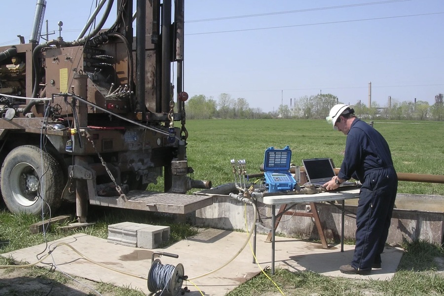
Registration of Field Parameters and Data Correction
In borehole geophysics, the parameters of the physical fields (e.g., seismic waves, electromagnetic fields, or magnetic intensity) are recorded by sensors placed in the borehole. However, these measurements are influenced by environmental factors such as temperature, pressure, borehole diameter, and the properties of the drilling fluid. To obtain accurate data, geophysicists must correct the raw measurements to account for these factors. After correction, the true values of the physical parameters are used to interpret the subsurface geology.
Borehole Geophysics in the Middle East
The Middle East is a region rich in oil and gas reserves, and borehole geophysics plays a crucial role in the exploration and development of these resources. Countries such as the UAE, Saudi Arabia, and Kuwait rely heavily on geophysical surveys to assess reservoir properties, monitor field development, and optimize production. Given the harsh operating conditions and the need for continuous field development, borehole geophysics is essential for ensuring the efficient extraction of oil and gas.
The region’s demand for advanced geophysical techniques is reflected in the numerous conferences and exhibitions held to showcase innovations in the field. Events like the Middle East Oil & Gas Show (MEOS) and the Middle East Geosciences Conference & Exhibition (GEO) highlight the growing importance of geophysical research in the Middle East’s energy sector.
Example: Smart Projects in the UAE
In the UAE, Smart Projects is a leading provider of geophysical survey services, offering cutting-edge solutions for mineral exploration, construction projects, and oil and gas development. Smart Projects specializes in a wide range of geophysical techniques, ensuring that clients receive the highest quality data for decision-making in resource management and infrastructure development.
Technical and Geological Problems Solved by Borehole Geophysics
Borehole geophysics is used to address both technical and geological challenges in resource exploration and extraction. Some of the key problems solved by borehole geophysics include:
Geological Problems:
- Parameter Determination for Resource Extraction: Borehole geophysics helps determine the necessary parameters for efficient extraction of resources such as oil, gas, and minerals.
- Accurate Calculation of Reserves: Detailed geophysical data are used to calculate the volume and quality of mineral reserves, ensuring accurate resource estimation.
- Mineral Identification and Characterization: Borehole geophysics identifies minerals and assesses their properties, such as porosity, permeability, and saturation.
- Geological Correlation: By correlating data between multiple boreholes, geophysicists can construct detailed geological sections that provide insight into the subsurface geology.
Technical Problems:
- Perforation and Blasting Operations: Borehole geophysics provides data for planning perforation and blasting operations, ensuring that they are carried out safely and effectively.
- Well Integrity Monitoring: Borehole geophysics is used to assess the technical condition of wells, including detecting corrosion, leaks, and other integrity issues.
- Reservoir Monitoring: Geophysical surveys monitor the development of oil and gas reservoirs, providing data on fluid movement and reservoir pressure, which are critical for optimizing production.
Conclusion
Borehole geophysics is a vital discipline that provides detailed information about the subsurface, supporting industries such as mining, oil and gas exploration, and construction. By using a variety of physical methods, borehole geophysics helps detect mineral bodies, assess rock properties, and calculate reserves, contributing to the efficient and safe extraction of natural resources. In regions like the Middle East, borehole geophysics is indispensable for managing vast oil and gas reserves, and companies like Smart Projects are at the forefront of providing these critical services.
As technology advances, borehole geophysics will continue to play a central role in the exploration and development of the Earth’s subsurface resources, driving innovation and ensuring sustainable management of our natural resources.

Skier, traveler, music blogger, hand letterer and HTML & CSS lover. Performing at the sweet spot between art and purpose to craft delightful brand experiences. German award-winning designer raised in Austria & currently living in New York City.